


Nilgiri Hills
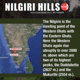
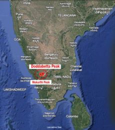
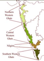
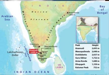
The #Nilgiris is the meeting point of the Western Ghats with the #Eastern_Ghats. Here the #Western_Ghats again rise abruptly to over 2000 m. above which are two of its highest peaks, the #Doda_Betta (2637m.) and the #Makurti (2554m.).
The link to join the course : Online Courses
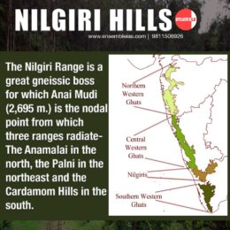
The Nilgiri Range is a great gneissic boss for which #Anai_Mudi (2,695 m) is the nodal point from which three ranges radiate- the #Anamalai in the north, the #Palni in the northeast and the #Cardamon Hills in the south.
GEOGRAPHY THROUGH MAPS – WORLD
Geography Through MAPs – India
The highest erosional surface with a flat or undulating summit meaning that is not peak like is found in the Nilgiri Hills at elevations of over 2,000 metres.
Geography Optional
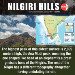
The highest peak of this oldest surface is 2,695 meters high, the Ana Mudi peak, meaning the one shaped like head of an elephant is a great gneissic boss of the Nilgiris.
The rest of the Nilgiri has a different topography altogether having undulating terrain.
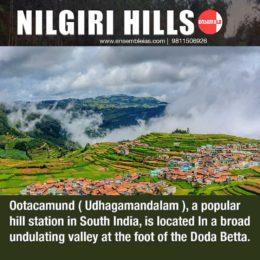
#Ootacmund (#Udhagamandalam), a popular hill station in South India, is located in a broad undulating valley at the foot of the #Doda_Betta.
Best Online Coaching for Civil Service_IAS_ UPSC_IFS_IPS
Free Study Material ENSEMBLE IAS ACADEMY | Call +91 98115 06926
Visit us:- https://ensembleias.com/ | Online Store: https://online.ensemble.net.in/
#Anai_Mudi, #Anamalai, #Cardamon_Hills, #Doda_Betta, #Eastern_Ghats., #highest_peaks, #Makurti, #Nilgiris, #Ootacmund, #Palni, #Udhagamandalam, #Western_Ghats, #ensembleiasacademy, #geographyoptional, #k_siddharthasir, #ias, #civilservices, #upsc_motivation, #upsc_aspirants, #upsc_exam,
.
