

These Islands are also called the Emerald Islands.
Location and Extent:
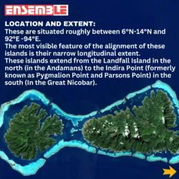
• These are situated roughly between 6°N-14°N and 92°E -94°E.
• The most visible feature of the alignment of these islands is their narrow longitudinal extent.
• These islands extend from the Landfall Island in the north (in the Andamans) to the Indira Point (formerly known as Pygmalion Point and Parsons Point) in the south (In the Great Nicobar).
The link to join the course : Online Courses
Origin:
The Andaman and Nicobar islands have a geological affinity with the tertiary formation of the Himalayas, and form a part of its southern loop continuing southward from the Arakan Yoma.
• The entire group of islands is divided into two broad categories:
The Andaman in the north, and The Nicobar in the south.
They are separated by a water body which is called the Ten degree channel.
• The Andaman islands are further divided into:
• Great Andamans
North Andaman
Middle Andaman
South Andaman
• Little Andaman
Also Read: Dr. Abdul Kalam Island
Little Andaman is separated from the Great Andamans by the Duncan Passage.
Chief Characteristics:
These are actually a continuation of Arakan Yoma mountain range of Myanmar and are therefore characterized by hill ranges and valleys along with the development of some coral islands.
GEOGRAPHY THROUGH MAPS – WORLD
• Some smaller islands are volcanic in origin, e.g., the Barren island and the Narcondam Island. Narcondam is supposed to be a dormant volcano but Barren perhaps is still active.
• These islands make an arcuate curve, convex to the west.
• These islands are formed of granitic rocks.
• The coastal line has some coral deposits, and beautiful beaches.
• These islands receive convectional rainfall and have an equatorial type of vegetation.
• These islands have a warm tropical climate all year round with two monsoons.
• The Saddle peak (North Andaman – 738 m.) is the highest peak of these islands.
The Great Nicobar is the largest island in the Nicobar group and is the southernmost island. It is just 147 km. away from the Sumatra island of Indonesia.
Geography Through MAPs – India
Recently our Prime Minister, Narendra Modi emphasised the need for developing an integrated tourism-centric ecosystem in some specified areas in these islands.
Home minister has made a provision to dispense with the requirement of Restricted Area Permit for foreigners visiting the Andaman and Nicobar Islands. Prime Minister called for expeditious pursuit of solar energy self-sufficiency in the islands which could be based on solar energy.
Best Online Coaching for Civil Service_IAS_ UPSC_IFS_IPS
Free Study Material ENSEMBLE IAS ACADEMY | Call +91 98115 06926
Visit us:- https://ensembleias.com/ | Online Store: https://online.ensemble.net.in/
#andamanandnicobarislands, #emeraldislands, #tropicalparadise, #islandecosystem, #arcuatecurve, #volcanicislands, #coralbeaches, #tropicalclimate, #sustainabletourism, #equatorialrainforest,


