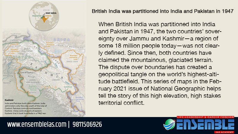
When British India was partitioned into India and Pakistan in 1947, the two countries’ sovereignty over Jammu and Kashmir—a region of some 18 million people today—was not clearly defined. Since then, both countries have claimed the mountainous, glaciated terrain. The dispute over boundaries has created a geopolitical tangle on the world’s highest-altitude battlefield. This series of maps in the February 2021 issue of National Geographic helps tell the story of this high elevation, high stakes territorial conflict. To buy our online courses Click Here

British India was partitioned
Read Also:India and China standoff and its effects
Source: Natgeomaps
#map #kashmir #india #pakistan #boundary #dispute


