The construction of several dams along the Brahmaputra river (known as Yarlung in China) on the Chinese side has become a repeated cause of concern for India.
As India and China continue to grow demographically as well as economically amid increased consumption among its citizenry, both nations face water constraints and in a race to develop new projects in order to overcome them.
About Chinese Project:
The interest of China on this river basin for hydropower dates back to 1980s. A scientific expedition led by Chinese Academy of Sciences – an in-depth hydrological study on Tsangpo-Brahmaputra basin – established the hydroelectricity power generation capacity (114,000 MW) of the basin and identified 12 dam sites.
The first gravity dam project – Zhangmu Dam – was approved for development in the Tibetan Autonomous Region (TAR) of China in 2010 and operationalized in 2015. While the construction of the dam prompted apprehensions for the lower riparian states, China maintained that the dam would not impact the downstream flow into these states since the dams were aimed at generating power and not storing water.
The state-owned hydropower company POWERCHINA signed a strategic cooperation agreement with the Tibet Autonomous Region (TAR) government to implement hydropower exploitation in the downstream of the Yarlung Zangbo river as part of the new Five Year Plan (2021-2025).
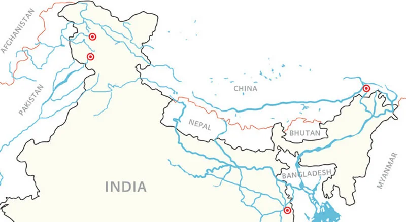
This will be the first time the downstream sections of the river will be tapped. However, the location of the planned project has not been mentioned anywhere.The Great Bend of the Brahmaputra and the Yarlung Zangbo Grand Canyon in Medog county, where the river turns sharply to flow across the border into Arunachal Pradesh could be the potential spot for the project.
This 50 km section alone offers a potential of developing 70 million kilowatt hours (Kwh).
China’s Previous Projects:
-
- In 2015,China operationalised its first hydropower project at Zangmu in Tibet, while three other dams at Dagu, Jiexu and Jiacha are being developed, all on the upper and middle reaches of the river.
Importance of the Project for China:
-
- The 60 million kWh hydropower exploitation could provide 300 billion kWh of clean, renewable and zero-carbon electricity annually.
- The project will play a significant role in realising China’s goal of reaching a carbon emissions peak before 2030 and carbon neutrality till 2060.
- The hydropower station could generate income of 20 billion Yuan ($3bn USD) annually for the. Tibet Autonomous Region
Chinese Perspective:
China is home to close to 20% of the world’s population and has only 7% of its water resources, which also faces severe pollution caused by rapid industrialisation. China’s southern regions are water-rich in comparison to the water-stressed northern part and to solve that, it plans to link the major rivers in these regions through canals, aqueducts and other linking projects to ensure water security.
For that, China has been blocking rivers like the Mekong and its tributaries, affecting Southeast Asian countries like Thailand, Vietnam, Laos and Cambodia.
China, being an upper riparian state in Asia, sees these projects as a continuation of its historic tributary system. The smaller states have no means of effectively resisting or even have significant leverage in negotiations. In the Himalayas, there are multiple operational dams in the Yarlung Tsangpo basin with more dams commissioned and under construction.
Chinese Strategy
Concerns Raised by India:
India has been expressing concerns on Brahmaputra since 2015 when China operationalised its project at Zangmu.
Interestingly, based on the scientific reports from then the Ministry of Water Resources (presently MoJS), any intervention on the Yarlung Tsangpo in the north aspect of the Himalaya cannot cause any substantial harm for downstream economies including India and Bangladesh, irrespective of Chinese intent, attributed largely to Zangmu project location..
However, the same cannot be stated for the present proposed project in the Medog county of TAR. This is because, the Medog county in TAR lies in the south aspect of the Himalayas, where the flow of the mainstream Yarlung is enhanced by the flow of another tributary Parlung Tsangpo
A dam at the Great Bend, if approved, would raise fresh concerns considering its location downstream and just across the border from Arunachal Pradesh.
For India, quantity of water is not an issue because these are run of the river dams and will not impact the Brahmaputra flow. More importantly, Brahmaputra is not entirely dependent on upstream flows and an estimated 35% of its basin is in India. However, India is concerned about the Chinese activities affecting the quality of water, ecological balance and the flood management.
Some these issues include:
Degradation of the Basin:
Massive amounts of silt carried by the river would get blocked by dams leading to a fall in the quality of soil and eventual reduction in agricultural productivity.
Threats to Flora and Fauna:
Brahmaputra basin is one of the world’s most ecologically sensitive zones and is identified as one of the world’s 34 biological hotspots. This region has several species of flora and fauna which are endemic to only this part of the world. The Kaziranga National Park houses 35 mammalian species out of which 15 are listed as threatened in the IUCN Red List. The river itself is home to the Gangetic river dolphin, which is listed as critically endangered.
Unfavourable Location:
The location of the dams also poses a risk as the Himalayas are one of the most vulnerable to earthquakes and seismic activity.
Landslides resulting from earthquakes pose a significant threat. For example, the 2015 Nepal earthquake and the resultant landslides wiped out several dams and other facilities.
Risk to Inhabitants:
Damming this perennial river would result in water security in an era of unprecedented shifting climate patterns.The sheer size of the infrastructure projects undertaken by China and increasingly by India, poses a significant threat to the populations living downstream.Close to a million people live in the Brahmaputra basin in India and tens of millions further downstream in Bangladesh.
Strategic Implications:
There is the potential to significantly change the flow rate during times of standoffs and high tensions. During the 2018 Doklam border standoff between India and China, China stopped communication of water flow levels from its dams, effectively rendering India blind to floods during the standoff.
However, the dangers perceived and anticipated from Chinese may not be of that magnitude and scale.
The Chinese may not be able to affect the flow of Brahmputra in India. There are reasons for it.
- The contribution of snow and glacial melt to the flow is substantially low in the overall stretch; however, its contribution is higher in the upper reaches of the flow which are in the rain-shadow region. A large part of the Tibetan component of the basin, i.e. the longer stretch of the Yarlung, is located in the rain-shadow north aspect of the Himalaya, and is therefore a recipient of much less rainfall as compared to the south aspect. Therefore, while the average annual precipitation in the trans-Himalaya is around 300 mm, the average annual precipitation (that includes mainly rainfall) reaches about 3,000 mm in the south aspect just after crossing the crestline. The foothills are frequently fed by anomalous precipitation of a magnitude that is capable of causing great floods.
- Though this geographical distribution of length gives an apparent impression that the maximum flow of the system occurs in the TAR of China, it is a myth! Rather, the system becomes stronger and fatter as it flows further downstream. It needs to be noted here that the Brahmaputra is identified as the flow downstream of the confluence of three tributaries, namely the Luhit, Dibang, and Dihang, near Sadiya in the Indian state of Assam.
This is borne by many facts
- While the peak flows at Nuxia and Tsela Dzong — measuring stations at the great bend in the Tibetan plateau — are about 5,000 and 10,000 cubic metres per second (cumecs), the peak flow at Guwahati in Assam is approximately 55,000 cumecs. The lean season flow in Nuxia is in the range of 300-500 cumecs, while the lean flow at Pasighat in India is to the tune of 2,000-plus cumecs, the one at Guwahati is around 4000-plus cumecs, and at Bahadurabad it is about 5,000 cumecs.
- At the same time, the sediment regime also follows the same pattern, with the run-off in the rain-shadow region not being sufficient to carry the massive sediment load recorded downstream. The Brahamputra’s large mainstream flows of water and sediments are contributed by many of its large tributaries including Dibang, Dihang (Siang), Luhit, Subansiri, Manas, Sankosh, Teesta, etc. While Nuxia records an annual suspended sediment load of around 30 million metric tonnes,
In any case, The potentially utilisable water resources or PUWR of the Brahmaputra is barely 25 per cent in terms of data from the erstwhile Ministry of Water Resources (presently MoJS). Therefore, given the precipitation, run-off and sediment flow regimes, it is unlikely that any intervention on the Yarlung Tsangpo in the north aspect of the Himalaya can cause any substantial harm for downstream economies including India and Bangladesh, irrespective of Chinese intent.
However, the same cannot be stated for the present proposed project in the Medog county of TAR. This is because, the Medog county in TAR lies in the south aspect of the Himalayas, where the flow of the mainstream Yarlung is enhanced by the flow of another tributary Parlung Tsangpo which shows an annual average precipitation of 3,000 mm, substantially higher than the 500 mm recorded at Nuxia.
Besides, the region, entailing the Great Bend at the intersection of the basins of Yigong Tsangpo, Parlung Tsangpo, and the Lower Yarlung, exhibit events like high monsoonal precipitation, strong possibilities of landslides and avalanches leading to flash floods, with the average annual frequency of such hazardous events being 10 or more.
Further even, Medog witnesses 12-15 such incidents on an average. The biggest concern of the space is its unpredictable tectonicity as is prevalent in large parts of Eastern Himalayan system. Therefore, any such event resulting in any form of dam burst or otherwise can have deleterious impacts on the immediate downstream particularly Arunachal Pradesh which will most likely experience sudden flooding. Arunachal Pradesh will also be affected if there is impounding of the flow through some storage mechanisms though the impact may not be felt further downstream after Sadiya.